
Fairfield ZIP Code Coverage
Fairfield County's postal map is made from several sources: the Connecticut post-office list, municipal and state associations, USPS by-address verification, and the Census 2020 ZCTA relationship file. The table keeps the postal place and municipality distinct. Some codes are delivery routes, some are station or branch associations, and some may be special or PO-box areas whose exact type was not located in the official material.
| ZIP | Area or postal association | Post office or place | Research note |
|---|---|---|---|
| 06468 | Monroe | Monroe | Postal association; verify exact streets. |
| 06470 | Newtown | Newtown | Census ZCTA intersects Fairfield County. |
| 06482 | Sandy Hook | Sandy Hook/Newtown | Town and postal label can differ. |
| 06484 | Shelton | Shelton | Municipal edge matters. |
| 06601 | Bridgeport | Bridgeport | Central association; verify delivery type. |
| 06602 | Bridgeport | Bridgeport | Downtown association. |
| 06604 | Bridgeport | Bridgeport PSCC | Postal and municipal fields are distinct. |
| 06605 | Bridgeport | Barnum/Bridgeport | Branch association near Fairfield line. |
| 06606 | Bridgeport | Beardsley/Bridgeport | Branch association. |
| 06607 | Bridgeport | East End/Bridgeport | Use USPS for the street. |
| 06608 | Bridgeport | Noble/Bridgeport | Branch association. |
| 06610 | Bridgeport | Bayview/Bridgeport | Branch association. |
| 06611 | Trumbull | Trumbull Station | Postal place may accompany municipal context. |
| 06612 | Easton | Easton Finance Unit/Bridgeport | Verify delivery address. |
| 06614 | Stratford | Stratford postal store | Stratford association. |
| 06615 | Stratford | Stratford Branch | Verify exact delivery street. |
| 06650 | Stratford | Stratford | Association type not located. |
| 06673 | Bridgeport | Bridgeport | Special or PO association not confirmed. |
| 06699 | Bridgeport | Bridgeport | Special or PO association not confirmed. |
| 06784 | Sherman | Sherman | ZCTA intersects Fairfield County. |
| 06801 | Bethel | Bethel | Official delivery association. |
| 06804 | Brookfield | Brookfield | Official delivery association. |
| 06807 | Cos Cob | Cos Cob | Greenwich-town postal place. |
| 06810 | Danbury | Danbury/Downtown Main | Branch or station context. |
| 06811 | Danbury | Danbury | Delivery type should be checked. |
| 06812 | New Fairfield | New Fairfield Station/Danbury | Classic municipal and postal mismatch. |
| 06813 | Danbury | Danbury | Association type not located. |
| 06814 | Danbury | Danbury | Association type not located. |
| 06816 | Danbury | Danbury | Association type not located. |
| 06817 | Danbury | Danbury | Association type not located. |
| 06820 | Darien | Darien/Noroton Heights | Official post-office association. |
| 06824 | Fairfield | Fairfield Finance Unit | Town Hall association. |
| 06825 | Fairfield | Fairfield/postal store | Not every Fairfield address uses it. |
| 06828 | Fairfield | Fairfield | Exact station type not located. |
| 06829 | Georgetown | Georgetown | Postal place spans a town context. |
| 06830 | Greenwich | Greenwich Avenue Station | Main Greenwich association. |
| 06831 | Greenwich | Glenville/Greenwich | Greenwich-town postal place. |
| 06836 | Greenwich | Greenwich | Exact delivery type not located. |
| 06838 | Greens Farms | Greens Farms | Postal place near Fairfield/Westport. |
| 06840 | New Canaan | New Canaan | Official delivery association. |
| 06842 | New Canaan | New Canaan | Exact delivery type not located. |
| 06850 | Norwalk | Norwalk | Central association. |
| 06851 | Norwalk | Norwalk | Norwalk association. |
| 06852 | Norwalk | Belden Station | Branch association. |
| 06853 | Norwalk | Rowayton | Norwalk municipality. |
| 06854 | Norwalk | Norwalk/South Norwalk | Verify exact street. |
| 06855 | Norwalk | Norwalk | Association type not located. |
| 06856 | Norwalk | Norwalk | Official post-office association. |
| 06857 | Norwalk | Norwalk | Association type not located. |
| 06858 | Norwalk | Norwalk | Association type not located. |
| 06859 | Norwalk | Norwalk | Association type not located. |
| 06860 | Norwalk | Norwalk | Association type not located. |
| 06870 | Old Greenwich | Old Greenwich | Greenwich-town postal place. |
| 06875 | Redding Center | Redding Center | PO-box or unique status not located. |
| 06876 | Redding Ridge | Redding Ridge | PO-box or unique status not located. |
| 06877 | Ridgefield | Ridgefield | Official delivery association. |
| 06878 | Riverside | Riverside/Greenwich | Greenwich-town postal place. |
| 06879 | Ridgefield | Ridgefield | Exact delivery type not located. |
| 06880 | Westport | Westport/Saugatuck | Official association. |
| 06881 | Westport | Westport | Exact delivery type not located. |
| 06883 | Weston | Weston Branch/Westport | Municipal and postal mismatch. |
| 06888 | Westport | Westport | Exact delivery type not located. |
| 06889 | Westport | Westport | Exact delivery type not located. |
| 06890 | Southport | Southport | Fairfield-town postal place. |
| 06896 | Redding | Redding | State association. |
| 06897 | Wilton | Wilton | Official delivery association. |
| 06901 | Stamford | Atlantic/Downtown Stamford | Station association. |
| 06902 | Stamford | Barry Place/West Avenue | Branch association. |
| 06903 | Stamford | Stamford | Exact delivery type not located. |
| 06904 | Stamford | Stamford | Exact delivery type not located. |
| 06905 | Stamford | Ridgeway | Branch association. |
| 06906 | Stamford | Glenbrook | Branch association. |
| 06907 | Stamford | Stamford postal store | Official state list. |
| 06910 | Stamford | West Avenue/Stamford | Verify exact street. |
| 06911 | Stamford | Stamford | Exact delivery type not located. |
| 06912 | Stamford | Stamford | Exact delivery type not located. |
| 06913 | Stamford | Stamford | Exact delivery type not located. |
| 06914 | Stamford | Stamford | Exact delivery type not located. |
| 06920 | Stamford | Stamford | Exact delivery type not located. |
| 06921 | Stamford | Stamford | Exact delivery type not located. |
| 06922 | Stamford | Stamford | Exact delivery type not located. |
| 06925 | Stamford | Stamford | Exact delivery type not located. |
| 06926 | Stamford | Stamford | Exact delivery type not located. |
| 06927 | Stamford | Stamford | Exact delivery type not located. |
| 06928 | Stamford | Stamford | Exact delivery type not located. |
This directory table is a research crosswalk, not a promise that every row is a delivery ZIP or a complete ZCTA. Verify an exact address with USPS before sending a request.
Fairfield Postal Names Behind ZIPs
Postal place names carry local history but do not replace a town. Cos Cob, Glenville, Old Greenwich, and Riverside are Greenwich-town postal places. Southport belongs to the Fairfield postal geography, while Greens Farms appears in the Fairfield and Westport context. Georgetown spans a Wilton, Weston, and Westport area. Redding Center and Redding Ridge have their own listed place names. New Fairfield Station appears in the state material with a Danbury association.
When a ZIP lookup returns a surprising city line, keep it. The result may explain why a deed, assessor, or directory uses a different spelling from a mailing label. The address should be researched in the municipality where the land sits, not in the post office named after the ZIP.
Use the Connecticut post-office list for place-name context, then verify the street with USPS.
Find Fairfield Residents by ZIP Code
A ZIP-first search has to narrow in stages because most public resident records are not ZIP-wide. Start with USPS to standardize the address. If the result gives a Fairfield County town, use that municipality's assessor or GIS system. Save the parcel IDs that fall inside the postal question. Move to the Town Clerk for deeds and plats, the state voter lookup for a named street clue, and local libraries for a historical year.
- Run the full street line, apartment or suite, city, state, and optional ZIP through USPS by-address mode.
- Write down the USPS city line and the municipal situs as two separate fields.
- Search the municipal Vision or GIS portal by street, owner, parcel, or map identifier.
- Use the parcel ID and legal description to connect any deed, plat, permit, or map request.
- For a named person, use the state voter or court route with town and date filters, not a guessed ZIP roster.
- For an old household, switch to city directories, census, newspapers, cemetery, or probate records.
Once the ZIP has narrowed the area to a street, the Fairfield street directory takes over with the address-keyed chain. ZIP is the first geography, not the final record key.
Fairfield ZIP-Capable Search Portals
USPS is the clearest ZIP-capable tool. Its modes are By Address, By City and State, and Cities by ZIP. Assessor portals sometimes accept ZIP as an optional filter, but they return that municipality or vendor's cards, not every parcel delivered through the postal code. Publicsearch land-record screens use name, document, and date rather than ZIP. The voter lookup uses name and street or town scope. GIS can display a broad area, but a county-wide ZIP filter is not a single official resident query.
| USPS by address | Street, apartment or suite, city, state, and optional ZIP; returns a standardized delivery line. |
|---|---|
| USPS by city and state | City and state search for associated ZIP choices. |
| USPS cities by ZIP | ZIP-to-city association, not a municipal boundary map. |
| Assessor or Vision | Usually street, owner, parcel, or map search; ZIP behavior is municipal. |
| GIS map | Parcel and layer browse that must be filtered by town and current map data. |
| Voter lookup | Name and street or town clue; no ordinary ZIP-wide public roster. |
The USPS ZIP Code Lookup is the correct verification screen for an exact delivery address.
Fairfield ZIP Codes and Town Lines
ZIP boundaries, postal-city labels, town lines, county intersections, and parcel boundaries are different maps. A property can have a Weston municipal situs and a Westport postal branch. A New Fairfield address can carry a Danbury association. Greenwich place names can identify a branch without naming a separate town. Those mismatches matter because land, tax, vital, and election records follow the municipality or event town, not the postal label.
Keep five fields in a research note: municipal situs, USPS city, ZIP, parcel or account ID, and legal description. Add the mailing address if it differs from the physical site. That set lets a clerk or assessor reconcile a request without guessing which office is meant.
Postal versus legal geography. ZIP Codes route mail. The Town Clerk records land where the parcel lies. The assessor and GIS follow the municipal parcel, while the Census ZCTA is a statistical approximation.
Fairfield ZCTA Crosswalk Limits
The Census 2020 relationship file explains why a ZCTA cannot be treated as every USPS delivery boundary. A valid ZIP may lack a ZCTA. A ZCTA may approximate, but not equal, a ZIP. Some ZCTAs represent institutions or PO-box areas. The Fairfield County relationship file intersects a narrower set of codes than the full postal association table and omits many special associations.
Use Census geography for cross-checking county intersections and broad population context. Use USPS for an address, the municipal assessor for a parcel, and the Town Clerk for a legal record. Do not use a ZCTA to assert that every household in a postal ZIP falls inside the same town or county.
The Census relationship-file guidance describes the distinction. Its national plain-text table supplies the machine-readable crosswalk.
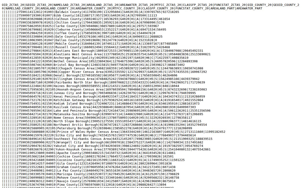
The relationship table is a geographic cross-check, not a name search or delivery-boundary index.
The national plain-text table gives the machine-readable county and ZCTA relationship used in the research.
The Census relationship-file guidance also documents the reference-file family used here.
Keep the Census file citation with its vintage because statistical geography can change independently of USPS delivery practice.
Fairfield ZIP Mismatch Examples
Three examples show why a ZIP code directory needs a note column. ZIP 06812 is listed with New Fairfield while the state post-office material associates New Fairfield Station with Danbury. ZIP 06883 can carry a Weston municipal address through a Westport branch label. ZIP 06612 is associated with an Easton finance unit and Bridgeport context. These labels do not change where a deed is recorded or which registrar maintains the official town list.
Greenwich adds Cos Cob, Glenville, Old Greenwich, and Riverside, all useful postal clues inside one municipal record geography. Fairfield and Westport add Southport and Greens Farms. Write the post-office place exactly as returned, then use the town and parcel to choose the next office.
Note: A ZIP mismatch is a routing clue, not evidence that the property belongs to the named post office or neighboring municipality.
Fairfield ZIP Research Fallbacks
If USPS does not resolve the address, ask the town's assessor, GIS, planning, public works, or 9-1-1 address authority which situs is assigned. If the street number changed, use the parcel ID, subdivision, legal description, old number, and nearest cross street. If the postal city differs from the town, put both in the request. A ZIP-only request is too broad for a land, voter, permit, or directory search.
For people, the fallback depends on the question. Use a town registrar for an official registration issue, a Town Clerk for a deed or map, DPH or a local registrar for a vital certificate, a courthouse for a case, and a library for a historical directory. The ZIP code directory gets a researcher to the right municipality; it does not replace that custodian's fields.